Investigating what lies beneath
UMKC grad student helps install seismic-monitoring components.
Much of what happens below the Earth’s surface is a mystery to scientists. So to help give them a better understanding of the planet’s tectonic processes and to map the Earth’s interior, the National Science Foundation (NSF) funded the Earthscope Project, which includes a transportable array system that moves across the country from west to east. This system is a network of 400 broadband seismographs located in temporary sites across the United States.
The seismographs are laid in a grid pattern about 40 miles apart. After two years, each instrument is picked up and moved to the next location on the eastern edge of the array. When the project is complete, nearly 2,000 locations will have been occupied during the program. According to the NSF, the goal of the project is to collect data that helps assess and mitigate the risks from earthquakes. The data will advance researchers’ knowledge of the mechanics of earthquakes and increases the possibility of earthquake prediction.
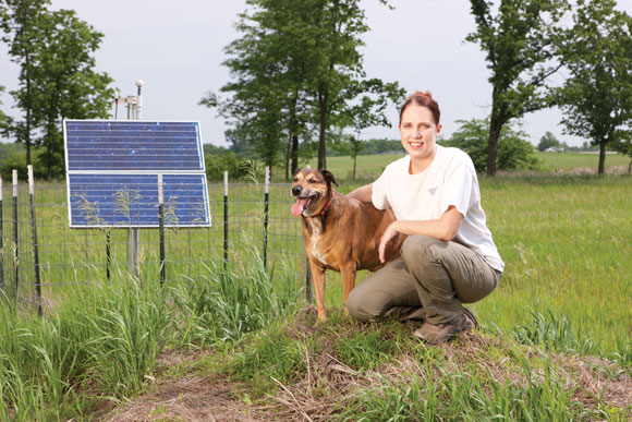
Katrina Burch, a graduate student in the Geosciences Department at UMKC, worked on scouting a location and installing the station that is housed near Smithville Lake in Missouri. Burch worked carefully to choose the site. “It had to be so many feet from road, and so many feet from houses in an area with cellular service,” she says. “It also had to be accessible by the construction vehicles and in a secure area so nobody could come and steal anything.” As Burch scouted the site, she snapped photos for the construction team to help with the installation process.
During installation, the construction team dug a giant hole, placed a culvert and filled the bottom with concrete. Then they installed a seismograph in the bottom and isolated it so it wouldn’t record extra noise. Two weeks later, the team returned and installed an electronic system to monitor and record the data the seismograph collects. Each site has its own solar power source and a modem that transmits the data.
When they’re fully functioning, the instruments pick up the wave paths of the energy approaching them, and the data tells researchers about what’s happening down below. “Two years isn’t a big window of time to observe something,” Burch says. “But it allows a better understanding of what’s underground.”
Data from each station are continuously transmitted to the Array Network Facility at the University of California, San Diego, where a team performs initial operational and quality checks. Then the team archives the data, and the public can view web pages for each station and review the data the instruments collect.
